IIT Bombay Deploys AI-Powered Natural Language Interface for Real-Time Satellite Imagery Analysis
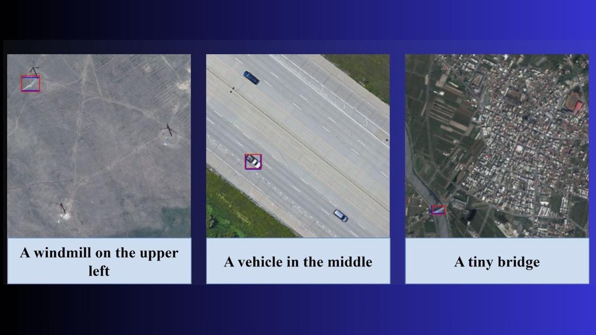
IIT Bombay has unveiled a groundbreaking artificial intelligence model capable of interpreting satellite imagery through natural language queries, marking a significant advancement in geospatial intelligence. The system enables users to locate specific objects—such as damaged infrastructure, vehicles, or agricultural features—by simply inputting descriptive text, bypassing traditional manual analysis. This innovation promises to accelerate disaster response and agricultural monitoring by providing near-instantaneous insights into flood impacts, crop health, and urban changes. However, intelligence analysts caution that while the technology demonstrates high potential for operational efficiency, rigorous field validation and scalability testing are essential before widespread deployment. The model's ability to translate complex visual data into actionable intelligence could redefine remote sensing protocols, though experts emphasize the need for robust accuracy assessments in diverse environmental conditions.